Use the METRO System Map and zoom into as much route detail as needed (play with Map, Satellite Views!)
Pick up a free quarterly Headways - Bus Riders Guide to carry with you, and plan your trip using the Maps, Route Locator, and instructions provided within
Be sure to check our Service Calendar and News Bulletins to make sure the trip that you intend to ride is operating that day
Weekday Service is labeled Sunday - Thursday (Su-Th)
Weekend Service is labeled Friday - Saturday (Fr-Sa)
Timetables
Timetables consist of aRoute Titleand a table in which Timepointlocations are the column headings, followed by rows of trips
Timepoint locations are major bus stops described in the column header and symbolized with capital letters (A, B, C...) These letters correspond to locations on the Route Map and System Map
Each row across the timetable follows that particular trip,showing the departure timepoint and location, and the arrival timepoint and location of the route's destination.
In between timepoints, there are usually more stops, which are shown on the maps, but are NOT shown in the timetable
A dash ( -- ) in place of an actual timepoint means that timepoint location is not served on that trip
Footnotes are sometimes shown under a timetable to convey additional information regarding that route or certain trips or timepoints on that route
To estimate when your bus will arrive at your location, reference the closest major timepoint (A,B,C...) described in the column header
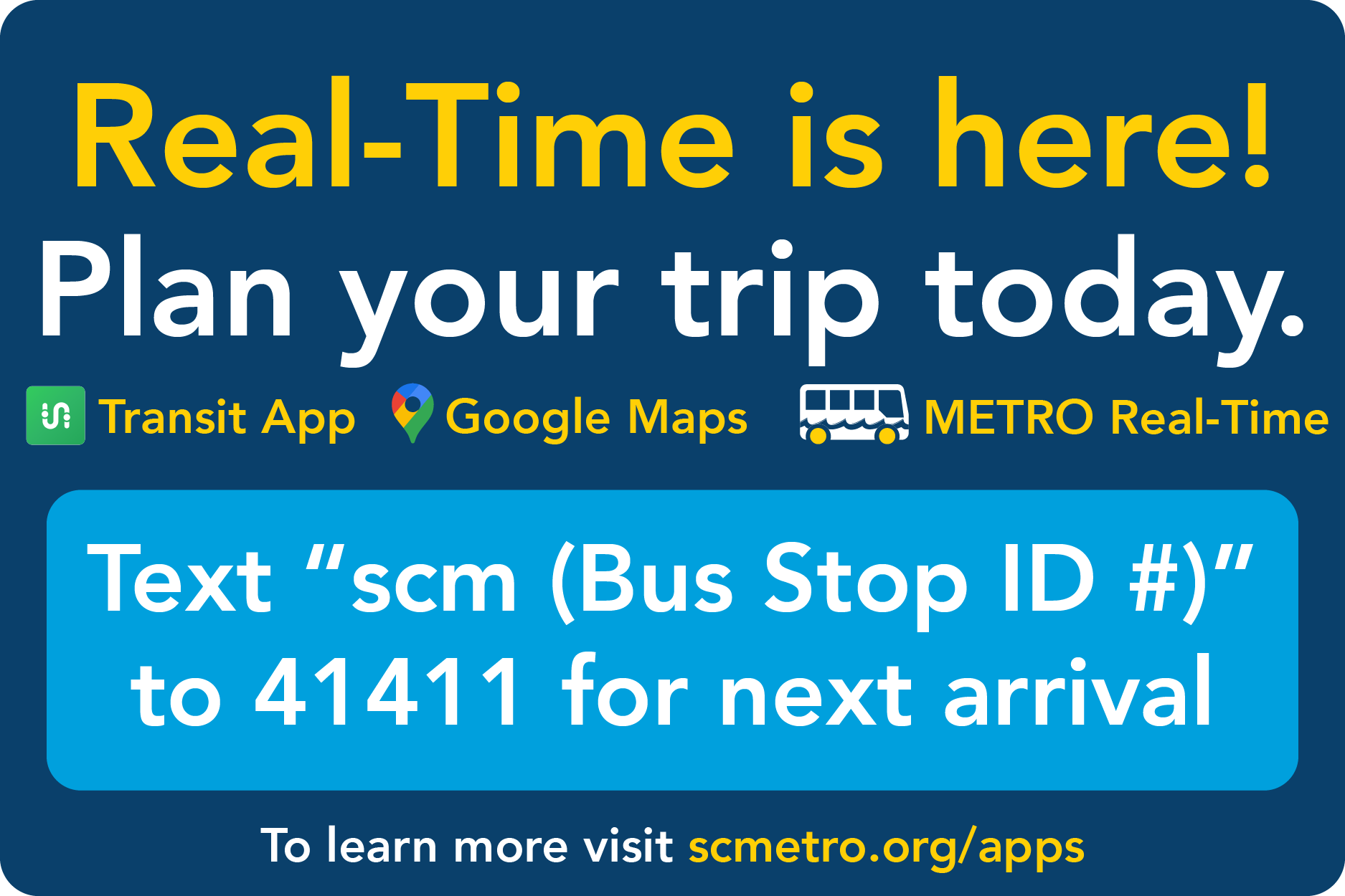
Google Transit trip plans will always calculate and display a stop's passing time for you
School Term (ST) Trips vs School Term Only Routes
Some routes designated School Term Only in the Route Title , run when related schools are insession. The School Term Calendar always includes the route schedule when applicable
Some routes have special trips marked with School Term (ST) in the timetable, indicating that particular trip only runs when related schools are in session
Stops
All bus stops are indicated by either a dot or a timepoint letter on the maps (see below)
Within certain technical limitations, all timepoint locations will be announced by the automated Call Stop Announcement System
Online System Map
The interactive Google Map on our website is called our System Map
It allows you to zoom in/out and see the context of the route including all stops and timepoints
Timepoints are shown as dark blue "pushpins" with bold white capital letters (A,B,C...)
Stops are shown as red dots with a bold yellow border and are clickable for more detail
To quickly zoom in to see a stop, click on it an choose the link "Zoom to location"
Switch from Map, Satellite, and Terrain views to actually see where stops are located in relation to known landmarks, buildings, steets, roads and elevation
Zooming in and out and panning can be done by using the map controls in the upper left
a double click will also zoom in one level, but this won't work while clicking on the route line, or the stops/timepoints
dragging the mouse (holding the mouse btton down while moving it over the map) will pan around the map while staying at the same zoom level
Use the Google traffic layercheckbox to show or hide a live traffiic overlay provided by Google
green lines mean traffic is flowing well
slower traffic ranges from yellow to red
road incident symbols also appear and are clickable for details
Route Maps
Route Maps are designed as the official "print version" map included with each route schedule and contain more detail than the System Map
A legend explains the symbols used
A solid dark-blue Route line shows the path of all trips
A dashed or styled dark blue Route line shows the path of selected trips which deviate from most trips and are explained in the text boxes in the map
White triangular directional arrowsindicate the path of travel along the route
a double arrow indicates that the route travels in both directions along that segment of the route
Timepoints are shown as dark blue "pushpins" with bold white capital letters (A, B, C...)
Stops are shown as pale yellow dots with a thin black border
 Español
 ") English (UK)
English (UK)